How to Share Point Cloud Files in Construction
Sharing point cloud files in construction projects means handling massive LiDAR data files, often in the gigabytes. These files capture precise 3D scans of sites and structures for planning and verification. Email and basic cloud drives compress them or take hours to transfer. Fastio streams uncompressed point clouds directly to teams, keeping accuracy for architects, engineers, and contractors.
What Are Point Cloud Files?
Point cloud files store millions of 3D data points from LiDAR scanners or photogrammetry. Each point records X, Y, Z coordinates, often with color and intensity values. Construction teams use them to create as-built models of sites, buildings, and infrastructure.
Point cloud sharing enables construction teams to collaborate on 3D scan data securely. Formats like LAS, LAZ, or E57 hold detailed geometry for clash detection, progress tracking, and renovations. A single site scan produces files from hundreds of MB to tens of GB.
In practice, field crews scan with handheld or drone LiDAR, then share raw data for office analysis. Accurate files prevent rework from mismatched models.
Why Sharing Point Clouds Matters in Construction
Construction relies on point clouds for precise measurements and visualization. They document existing conditions before demolition or expansion. Teams compare scans against BIM models to spot deviations early.
Sharing these files coordinates architects, structural engineers, MEP designers, and subs. Field access lets foremen verify installations on-site. Without reliable sharing, delays pile up from version mismatches or access issues.
Point clouds appear in 60% of large projects for quality control and digital twins. Fast transfer keeps schedules tight.
Key Use Cases
Site surveys feed into Revit or Navisworks models. Progress scans track steel erection against plans. Renovation teams overlay historical data with new captures.
Challenges When Sharing Large Point Cloud Files
Point cloud files hit GB sizes quickly. Email caps at 25MB after compression ruins detail. FTP or USB drives risk data loss and version confusion.
Basic cloud storage like Dropbox compresses uploads or throttles speeds. Download waits frustrate mobile users on job sites. Security gaps expose sensitive site data.
Bandwidth limits slow rural transfers. No native previews mean full downloads before review.

Top Tools for Point Cloud Sharing
Compare options for construction point cloud transfer:
Fastio stands out with on-demand streaming. No buffering for massive LAZ files. Viewers access without storage.


Stream Point Clouds Without Limits
Set up secure sharing for your construction team. Unlimited files, team invites, and previews included.
How to Share Point Cloud Files with Fastio
Fastio handles large point cloud transfer for construction. Steps take minutes.
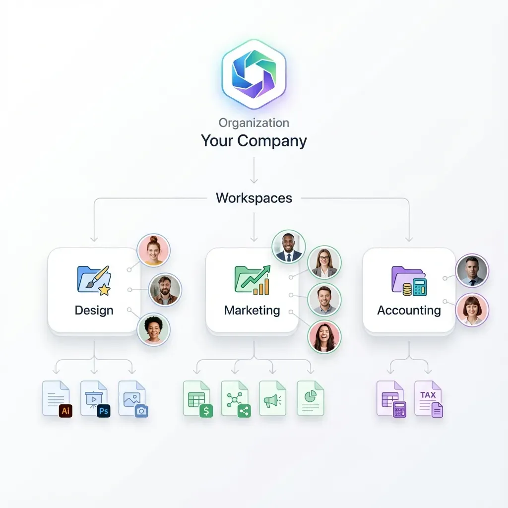
Create Workspace: Log in, new workspace for project like "Site A Scan". Invite team.
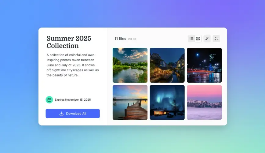
Upload Scans: Drag LAZ/E57 files. Chunked for 50GB+ sizes. Progress bar shows status.
Set Permissions: Folder-level access for subs. View-only for clients.
Generate Share: Branded link with password/expiry. Embed in emails or portals.
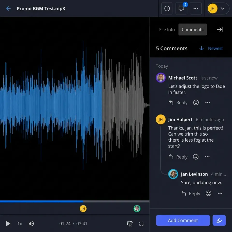
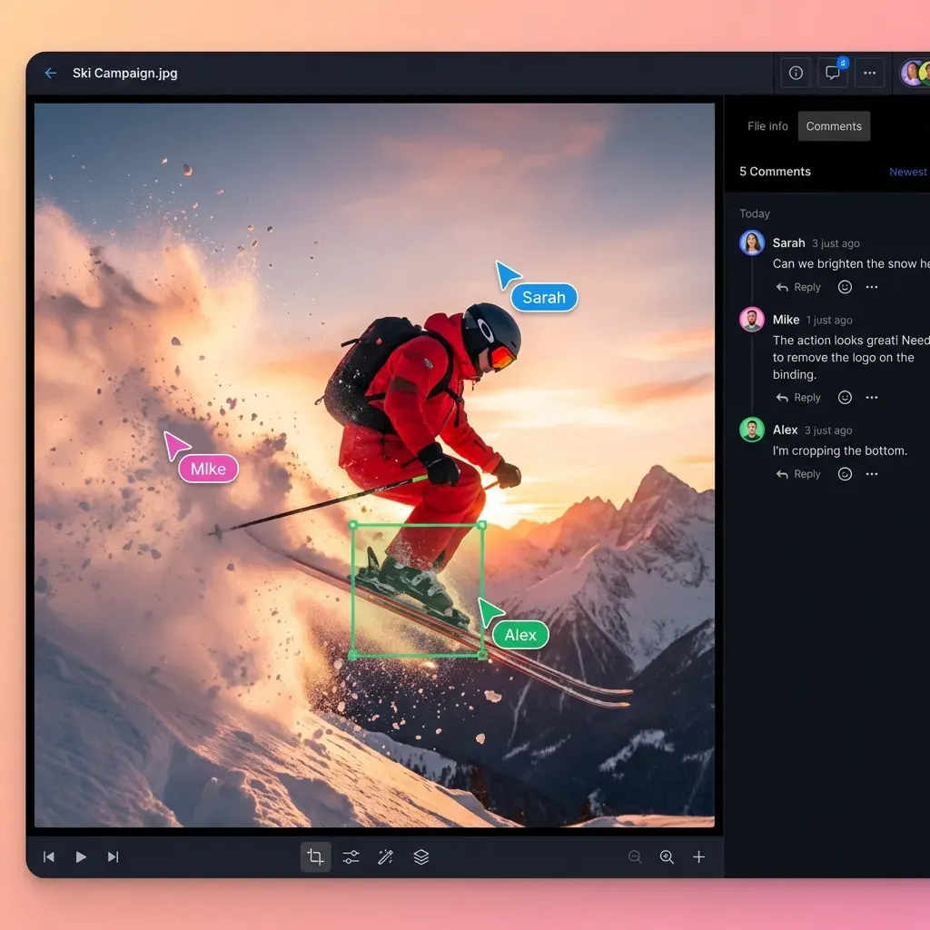
Collaborate Live: Real-time presence. Comment on scans. Mobile previews.
Recipients stream without download. Perfect for field checks.
Verify Upload
Check file integrity post-upload. Metadata confirms point count.
LiDAR Data Collaboration Best Practices
Organize folders by scan date and location. Use versioning for changes.
Enable Intelligence Mode for semantic search: "Find steel beams from week 3". Audit logs track views/downloads.
Mobile access lets foremen pan/zoom on iPads. Export subsets for quick shares.
Integrate with Revit via universal previews. No plugins needed.
Frequently Asked Questions
How to share point cloud files?
Use Fastio for direct upload and branded links. Streams GB files without compression. Set permissions and track access.
Construction LiDAR collaboration?
Create shared workspaces. Real-time comments and previews keep architects, engineers, and field teams aligned.
What size point cloud files does Fastio support?
Unlimited size with chunked uploads. Handles 100GB+ LAZ from full site scans.
Do point clouds compress when shared?
Fastio streams originals. No quality loss unlike email or basic drives.
Can subs access point clouds on mobile?
Yes. Browser previews work on phones/tablets. No app install.
Related Resources

Stream Point Clouds Without Limits
Set up secure sharing for your construction team. Unlimited files, team invites, and previews included.